From early on, the storms gave all mariners nightmares. While they put on quite a show, they can cause significant damage in a short time, ending in a possible shipwreck. Therefore, it is crucial to understand their origin and development principles, know the dangers they cause, observe the risk of their occurrence, and avoid them in time.
In general, storms are dynamic weather phenomena caused by atmospheric disturbance. They form when a centre of low pressure (large or small scale) develops with high pressure surrounding it. Storms usually manifest themselves by significant disruptions to normal conditions that bring hardships to boats on the sea and in berths. Traditionally, they are accompanied by winds (usually up to 3x stronger than stable winds), rain and limited visibility, hail causing potential injury to the crew or damage to the boat, high and irregular waves, lightning threatening both the people aboard and also significant sudden changes in sea level.
Types of storms
According to their formation process, we divide storms into frontal and non-frontal. The development of frontal storms is associated with low-pressure and frontal systems. Barometric pressure will fall as a warm front approaches. It is announced long in advance, creating tall clouds, which gradually lower, and as the front advances, eventually, rainfall increases.
However, these are not thunderstorm phenomena. Behind the warm front, clearing and warming are usually rapid. Such a change can raise hope for people without meteorological knowledge – they may think the bad weather is over. But, sooner or later, the cold air mass replaces the warm air mass. As the cold front advances, without high-level clouds in advance, cumulonimbus clouds producing thunderstorms commonly form at the front boundary. Sunny weather can therefore change directly into a more or less intense thunderstorm in the blink of an eye. Once the storm is over, another precipitation begins (the non-storm type), and at the same time, the temperature starts cooling suddenly.
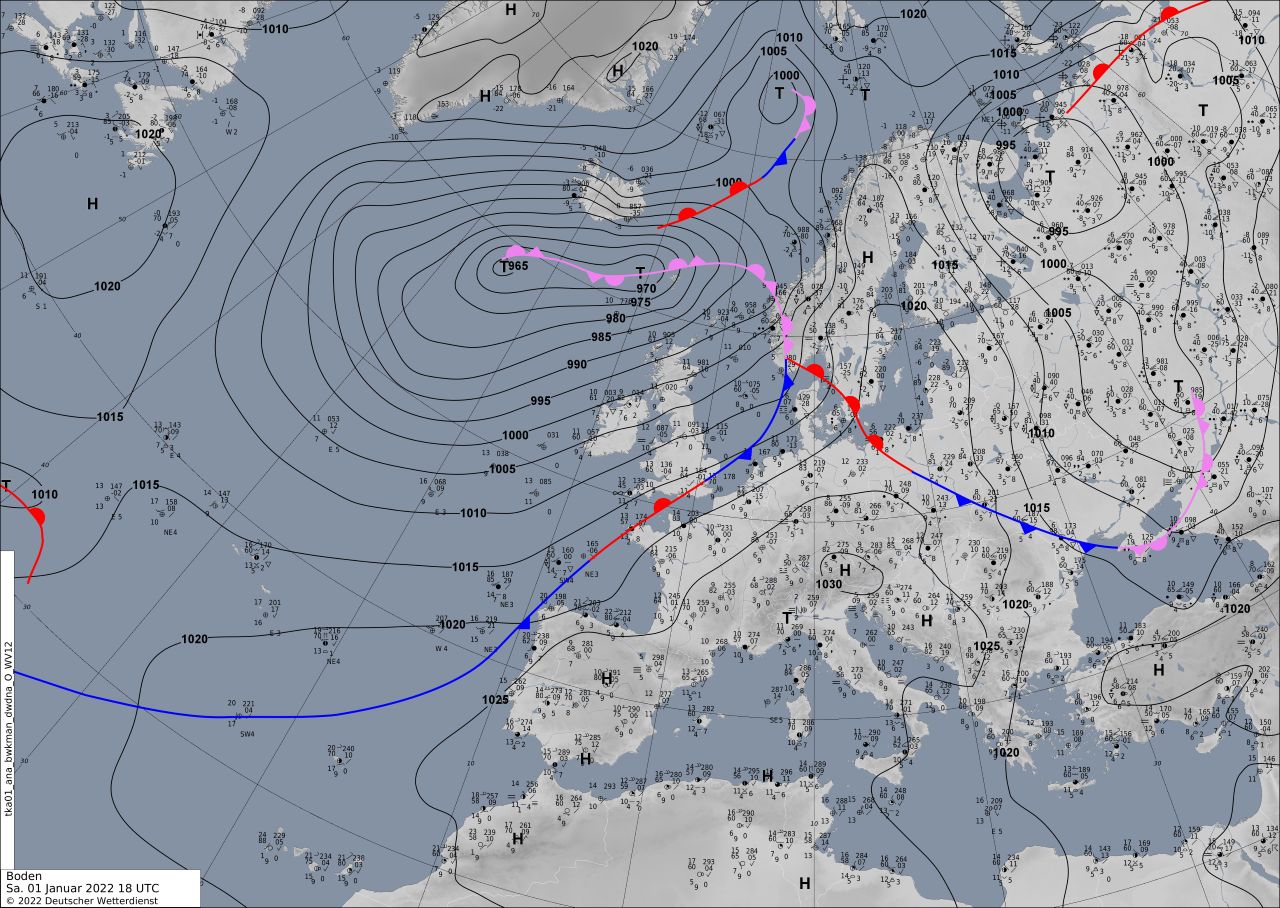
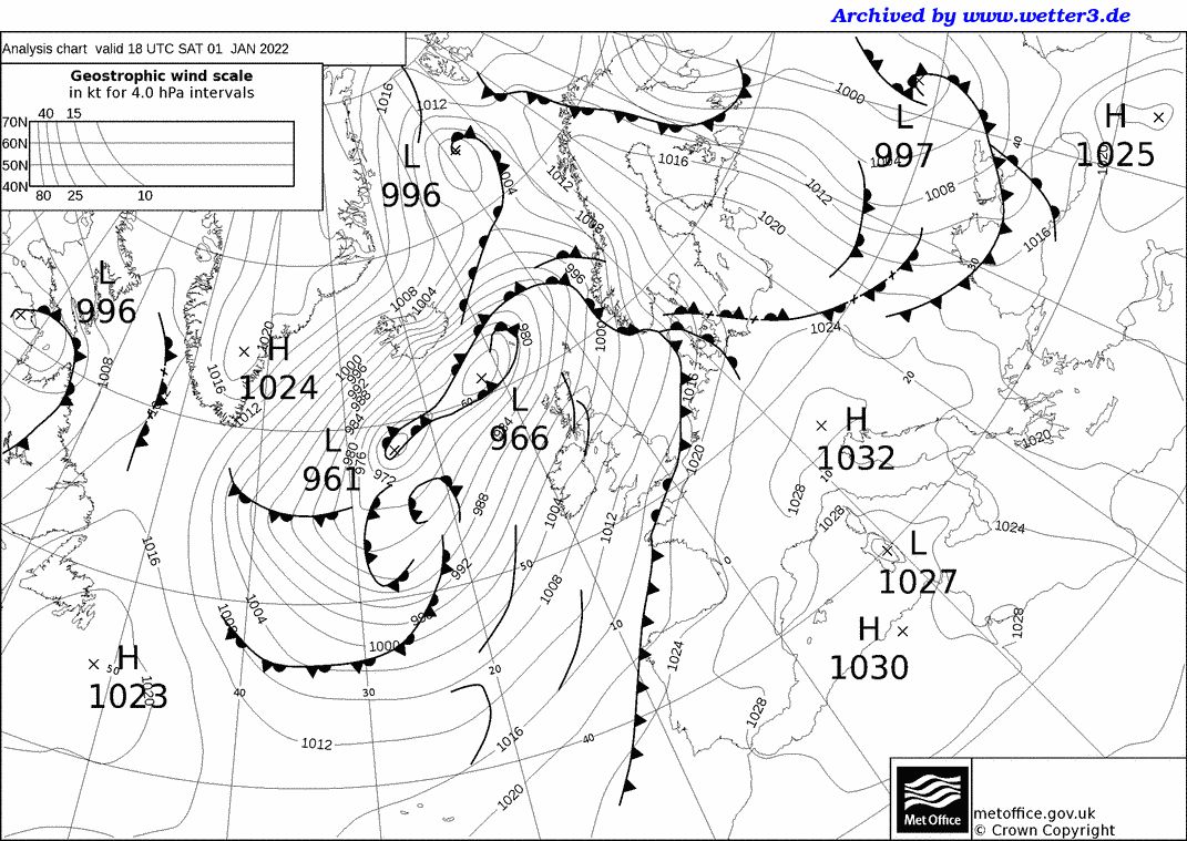
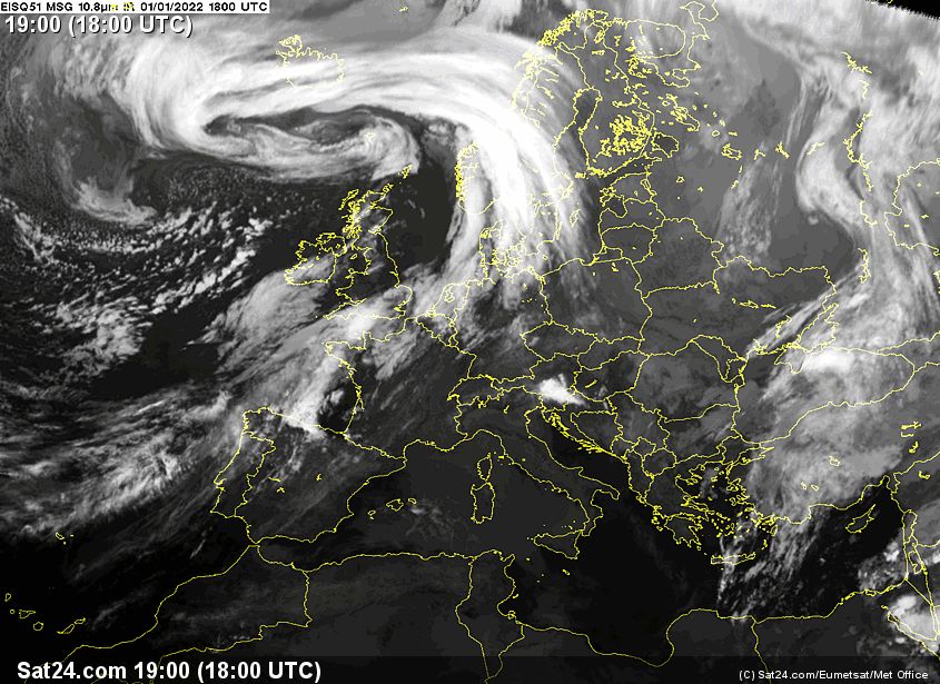
Frontal storms last relatively long and are therefore well predictable. The risk of their occurrence is obvious from the synoptic map. In addition, the clouds associated with frontal storms and their movement can be observed in images from meteorological satellites.
Storms of various types and origins are considered to be non-frontal storms. For instance, a common type is a summer local storm. It forms as the surface (either land or sea) significantly warms up, which leads to heating the moist air mass. As the warm air rises gradually into the higher and colder layers of the atmosphere, it condenses to form storm clouds. Such storms usually affect a minimal area. However, they are tough to predict, and local geomorphological parameters are crucial for their formation. Therefore, it is worth following local weather forecasts and reading good sailing guides, which contain information about areas commonly affected by local storms and their conditions (season, weather conditions, etc.).
Air pressure changes
Non-frontal storms also form in areas with falling air pressure – places of continuous linear instability of the pressure field. On a synoptic map, pressure drops are labelled with longer or shorter lines (about 10 NM wide and tens or hundreds of NM long). Such areas can be traced from the meteorological map, and it is possible to prepare for their arrival in time. However, the extent and movement of the area in which they occur are rather important than the exact location of the pressure drops plotted on the map, which changes very dynamically over time.
Other non-frontal storms sometimes form in the mid-latitude region (30°–60° latitude) on the east side of the high-pressure systems. There, the air masses of very different temperatures and moisture clash. Such non-frontal storms are sometimes referred to as pseudo-frontal storms.
For yachters, there are only two possible strategies for safely overcoming a storm – either to be in a safe port at a time for its arrival or, conversely, to stay out at sea at a sufficient distance from the coast and dangerous shallows throughout its duration. Keep in mind, never head back to the port during the storm!
